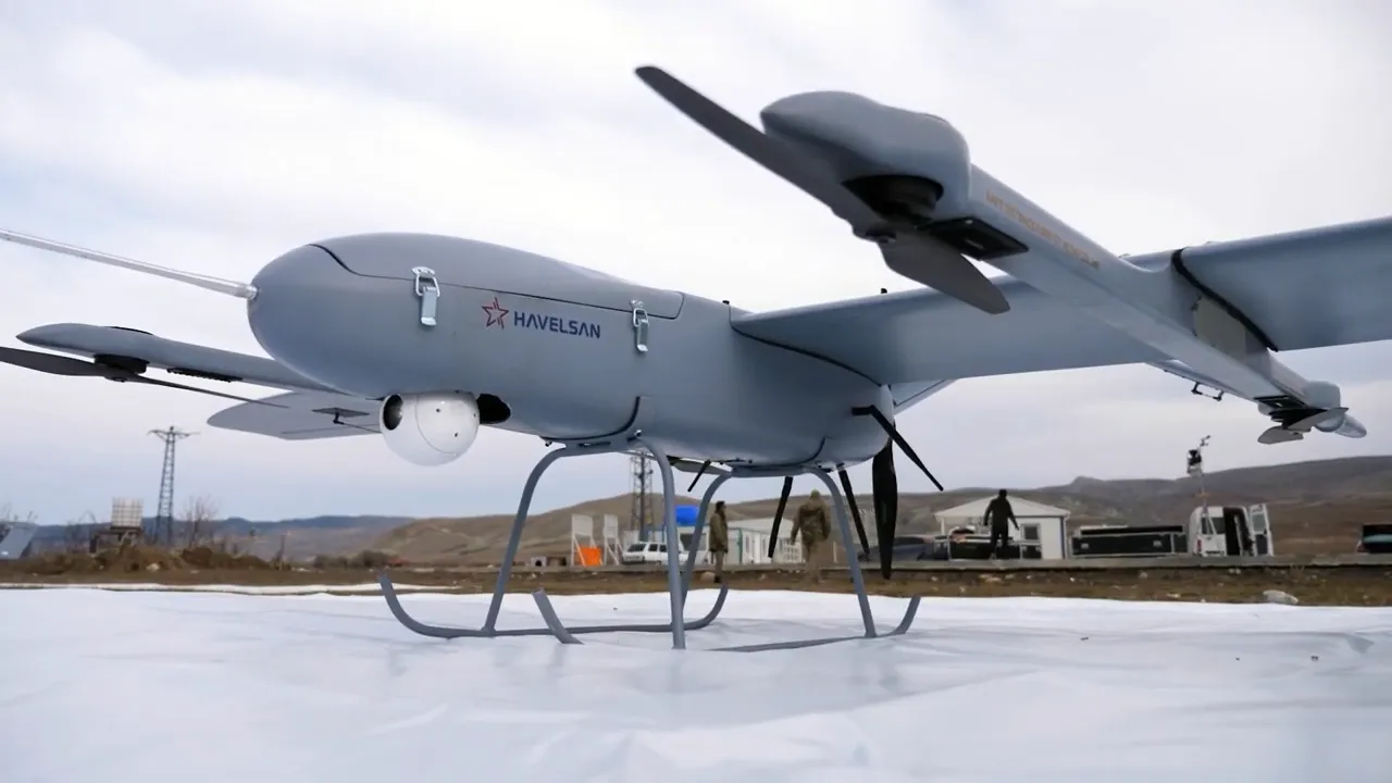
Enquire about Robot

Simply fill up the form, our team will then reach out to you to connect to the relevant parties who can help facilitate your request.

Brand & Model
All fields required. Refer to our privacy policy for questions.
Thank you! Your submission has been received!
Oops! Something went wrong while submitting the form.

BAHA

Autonomous VTOL UAV with 2-hour endurance, 50 km range, and GPS-denied capability for ISR, surveillance, and disaster response missions.
Software Type
Closed Source
Software Package
Uses HAVELSAN autonomous flight control software.
Aparobot Readiness Score
ARS?
0
...
Actuators
Eletric propulsion system.
Compiute
Sensors
Equipped with EO/IR/LRF Integrated Pro Camera, Multispectral Camera, GPS/GNSS Anti-Jam System
Max Op. time
120
mins

Recent Robot Videos

*Aparobot claims no ownership of videos posted unless otherwise stated.
Description text
Date
  1. https://www.youtube.com/watch?v=vIO2_OhCAH8, The sky had a new hero at IDEF 2025, 2025-07-23
  2. https://www.youtube.com/watch?v=IPCs9Hl-LZU, BAHA UAV’s Role in AFAD's Earthquake Drill, 2024-11-19

Robot Brief

The BAHA is a compact sub-cloud autonomous VTOL unmanned aerial vehicle (UAV) developed by HAVELSAN for intelligence, surveillance, reconnaissance (ISR), and multi-role missions in both military and civilian environments. Designed for operations below cloud level, BAHA combines vertical take-off and landing capability with fixed-wing flight efficiency, enabling deployment in confined or rugged areas without runways. The aircraft features a lightweight airframe, modular payload architecture, and AI-driven autonomy, allowing it to operate effectively in GPS-denied environments while delivering real-time situational awareness through advanced sensor systems.

Use Cases

  • ISR (Intelligence, Surveillance & Reconnaissance):
    Provides real-time aerial intelligence using EO/IR sensors and imaging systems.
  • Border & Coastal Patrol:
    Monitors large areas for security, intrusion detection, and illegal activities.
  • Disaster Response & Search Operations:
    Supplies live aerial footage for rescue coordination and damage assessment.
  • Environmental Monitoring:
    Tracks forest fires, pollution, and land usage changes.
  • Agriculture & Industrial Inspection:
    Supports crop monitoring and infrastructure inspection missions.

Industries

  • Defense & Military:
    Tactical ISR, border security, and reconnaissance in contested environments.
  • Homeland Security:
    Surveillance, anti-smuggling, and public safety monitoring.
  • Disaster Management:
    Real-time situational awareness during emergencies and natural disasters.
  • Agriculture & Environment:
    Crop monitoring and environmental analysis using aerial imaging.
  • Energy & Infrastructure:
    Inspection of pipelines, power lines, and industrial assets.

Specifications

Length
-
2100
mm
Width
-
4000
mm
Height (ResT)
-
mm
Height (Stand)
-
mm
Height (Min)
-
mm
Height (Max)
-
mm
Weight (With Batt.)
-
28
kg
Weight (NO Batt.)
-
kg
Max Step Height
-
mm
Max Slope
+/-
-
°
Op. Temp (min)
-
-10
°C
Op. Temp (Max)
-
50
°C
Ingress Rating
-
No items found.

Intro

The BAHA UAV is a lightweight, sub-cloud autonomous aerial platform engineered to operate effectively in low- to mid-altitude environments where traditional high-altitude UAVs are less optimal. Developed by HAVELSAN, the system is specifically designed for operations below cloud cover, with a maximum ceiling altitude of 10,000 ft and an operational altitude of up to 8,000 ft. This positioning allows BAHA to deliver high-quality visual intelligence and situational awareness in conditions where visibility and responsiveness are critical, such as urban environments, mountainous terrain, and disaster zones.

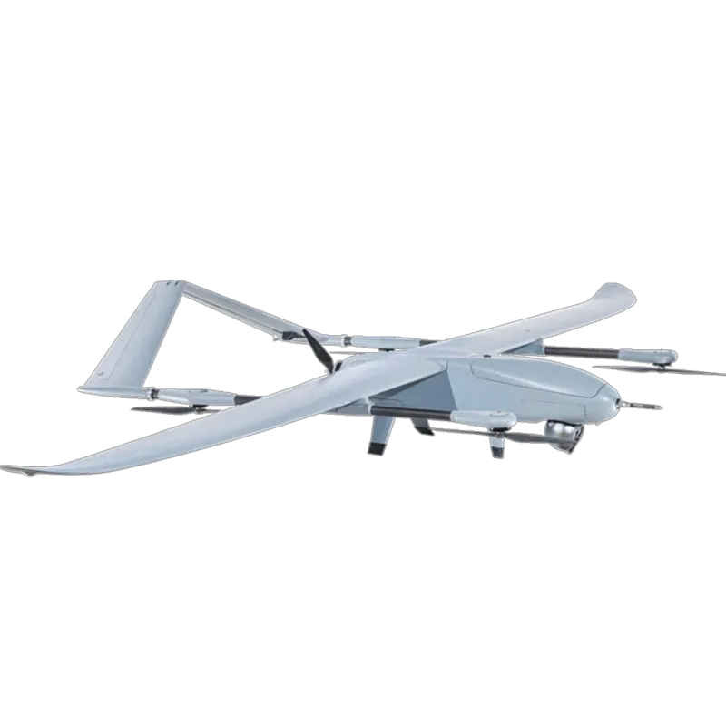
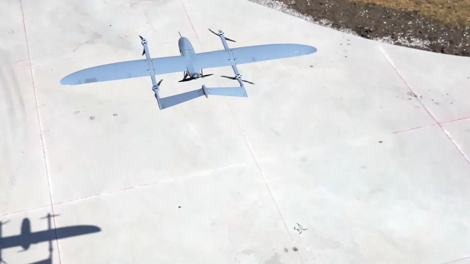
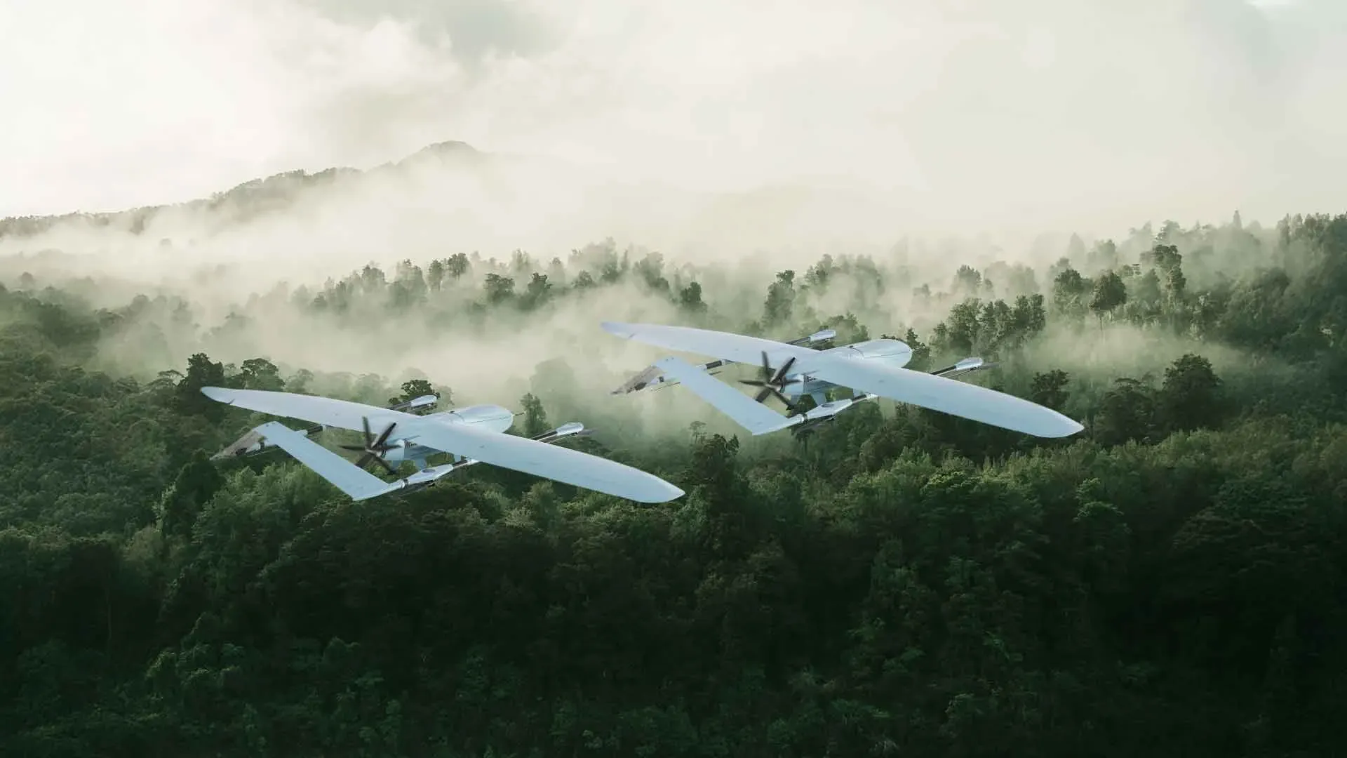
The aircraft features a hybrid aerodynamic configuration that combines vertical lift rotors with fixed-wing forward flight. This design enables seamless transition from hover to cruise mode, allowing the UAV to take off and land vertically in confined areas while benefiting from the endurance and efficiency of fixed-wing flight during missions. The platform is engineered to maintain stable flight performance under challenging weather conditions, with wind resistance of up to 15 knots during take-off and landing and up to 25 knots during cruise flight, ensuring operational reliability across a wide range of environments.

A defining characteristic of BAHA is its autonomous mission capability, supported by AI-driven navigation and control systems. The UAV can execute pre-defined missions independently, including waypoint navigation, obstacle avoidance, and automatic return-to-home in the event of communication loss. It is also capable of operating in GPS-denied environments, making it resilient against signal disruption or electronic warfare scenarios. These capabilities enable continuous mission execution even in contested or degraded communication environments.

The platform supports a modular payload system, allowing integration of electro-optical, infrared, and specialized mission sensors depending on operational requirements. In addition, BAHA is designed to support swarm operations, enabling multiple UAVs to coordinate and execute missions collaboratively. This combination of autonomy, environmental resilience, and modularity positions BAHA as a versatile UAV platform suitable for both military ISR missions and civilian applications such as environmental monitoring, infrastructure inspection, and disaster response.

Connectivity

  • Data link range up to 50 km
  • Real-time telemetry and video transmission
  • Ground control station integration

Capabilities

  • Rapid Vertical Take-off and Landing (VTOL):
    Enable rapid runway-independent deployment by a small team in confined or rugged environments
  • Autonomous Mission Execution:
    Capable of fully autonomous flight including navigation, mission execution, and landing.
  • Fixed-Wing Cruise Efficiency:
    Transitions to forward flight for extended endurance and large-area coverage.
  • Modular Payload Integration:
    Supports EO/IR cameras, thermal sensors, and mission-specific payloads.
  • Swarm Operation Capability:
    Multiple UAVs can coordinate missions for enhanced operational effectiveness.
  • GPS-Denied Operation:
    Capable of operating without GPS signals, making it resilient against jamming and electronic warfare.
  • Sub-Cloud Operational Capability:
    Optimized for low-altitude missions below cloud cover, improving visibility and intelligence gathering.