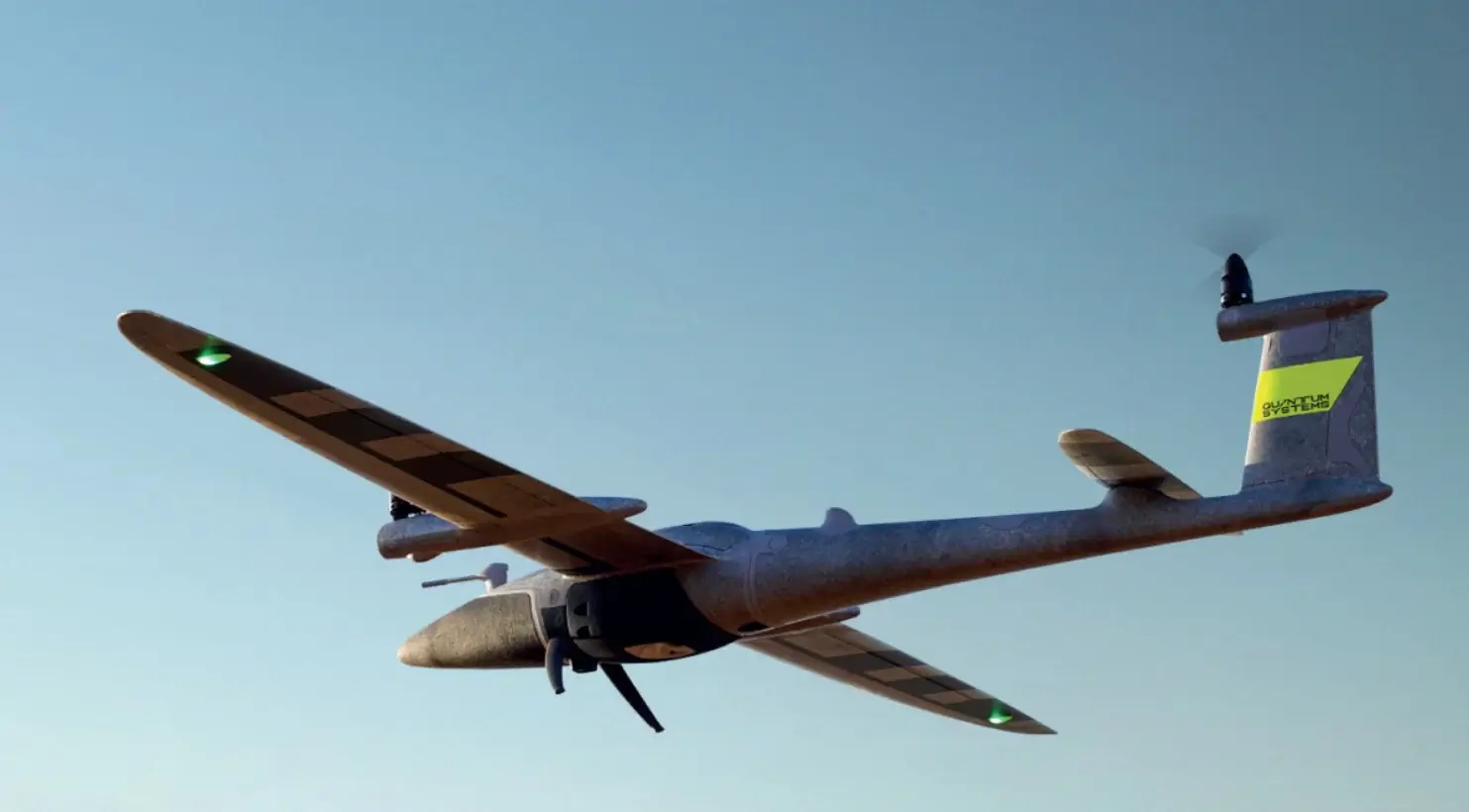
Enquire about Robot

Simply fill up the form, our team will then reach out to you to connect to the relevant parties who can help facilitate your request.

Brand & Model
All fields required. Refer to our privacy policy for questions.
Thank you! Your submission has been received!
Oops! Something went wrong while submitting the form.
HomeRobots

Trinity Pro

Long-endurance eVTOL mapping drone with 90-minute flight time, modular sensors, and vertical launch capability for aerial surveying, mapping, and reconnaissance missions.
Software Type
Closed Source
Software Package
Uses proprietary QBase 3D Software, for mission planing.
Aparobot Readiness Score
ARS?
0
...
Actuators
Compiute
Onboard Linux mission computer integrated with Quantum-Skynode autopilot, enabling advanced mission workflows and future AI features.
Sensors
Sensor payload includes RGB camera (Phase One P5, Sony ILX-LR1), oblique imaging system (Oblique D2M), and LiDAR (Qube 640).
Max Op. time
90
mins

Recent Robot Videos

*Aparobot claims no ownership of videos posted unless otherwise stated.
Description text
Date
  1. https://www.youtube.com/watch?v=7x1wbgh1uko, Protecting Namibian megafauna and promoting sustainable land use with Trinity Pro, 2023-07-18

Robot Brief

The Trinity Platform is a professional Electric Vertical Take-Off and Landing (eVTOL) fixed-wing Unmanned Aerial System developed by Quantum-Systems for long-endurance aerial mapping, surveying, and reconnaissance missions. Designed to combine the operational flexibility of multirotor drones with the aerodynamic efficiency of fixed-wing aircraft, the Trinity platform enables vertical launch and recovery without runways while maintaining long flight endurance and large-area coverage capabilities. The platform supports multiple variants, most notably Trinity Pro, designed for commercial geospatial data acquisition, and Trinity Tactical, developed for defense and intelligence applications. Both variants share the same core airframe and flight architecture but differ in payload options, communications systems, and mission focus.

Use Cases

  • Aerial Mapping & Surveying:
    Captures geospatial data for topographic maps and orthomosaics.
  • Corridor Mapping:
    Efficiently maps long linear features (e.g., roads, pipelines) in a single flight.
  • Aerial Photogrammetry:
    High-resolution imagery output for 3D reconstruction.
  • LiDAR Scanning:
    Provides 3D point cloud data with compatible LiDAR payloads.
  • Precision Agriculture:
    Multispectral data supports crop health and vegetation analysis.

Industries

  • Surveying & Mapping:
    Used for cadastral, construction, and land surveying.
  • Infrastructure Inspection:
    Corridor asset inspection (roads, utilities).
  • Environmental Monitoring:
    Forestry, coastal, and terrain change tracking.
  • Mining & Construction:
    Volume measurement and site planning.

Specifications

Length
-
1491
mm
Width
-
2394
mm
Height (ResT)
-
mm
Height (Stand)
-
mm
Height (Min)
-
mm
Height (Max)
-
mm
Weight (With Batt.)
-
kg
Weight (NO Batt.)
-
kg
Max Step Height
-
mm
Max Slope
+/-
-
°
Op. Temp (min)
-
-12
°C
Op. Temp (Max)
-
50
°C
Ingress Rating
-
IP55
No items found.

Intro

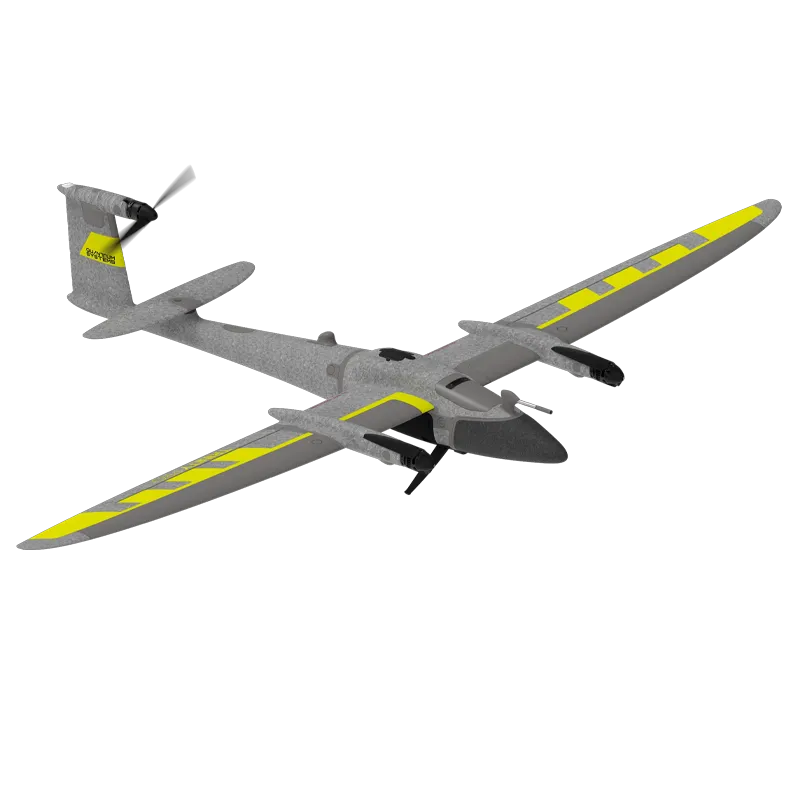
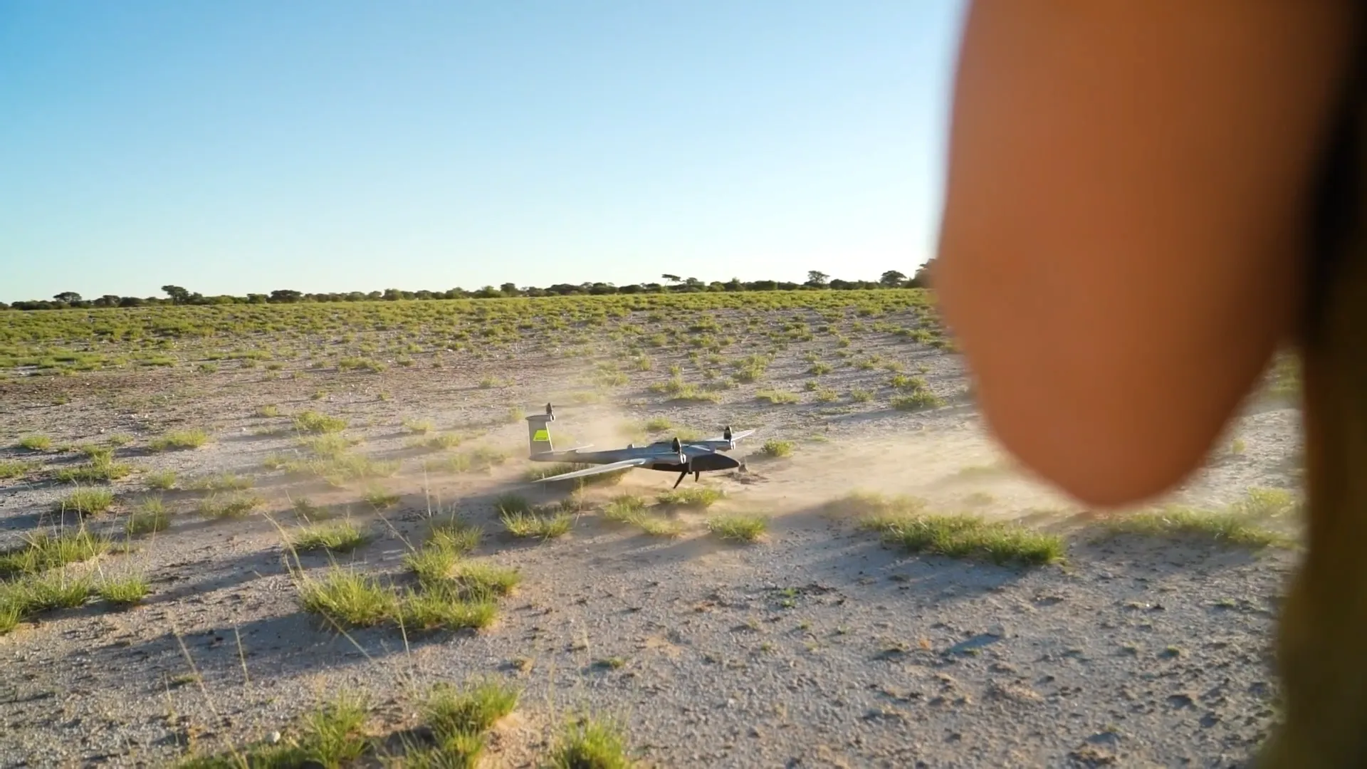
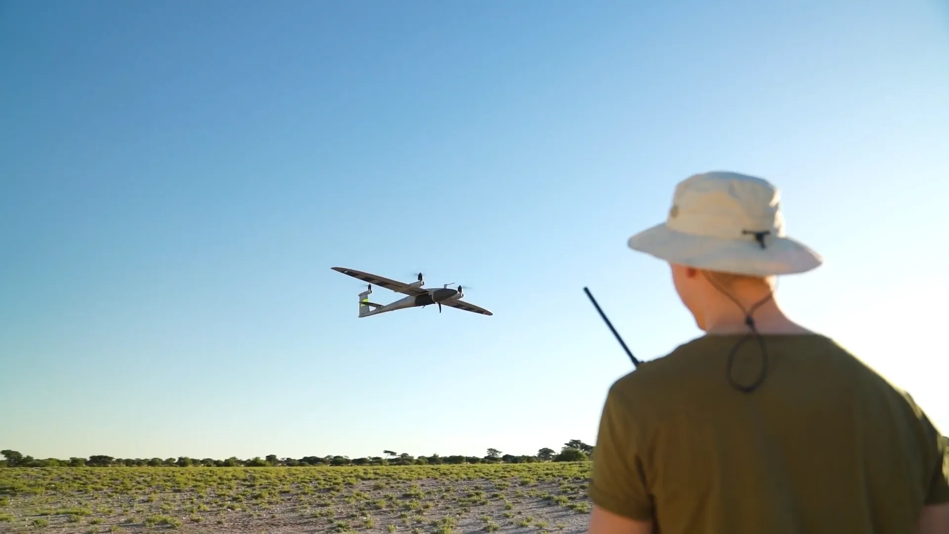
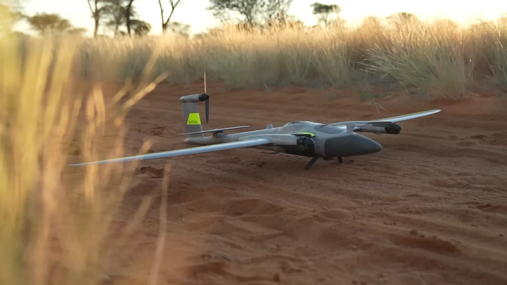
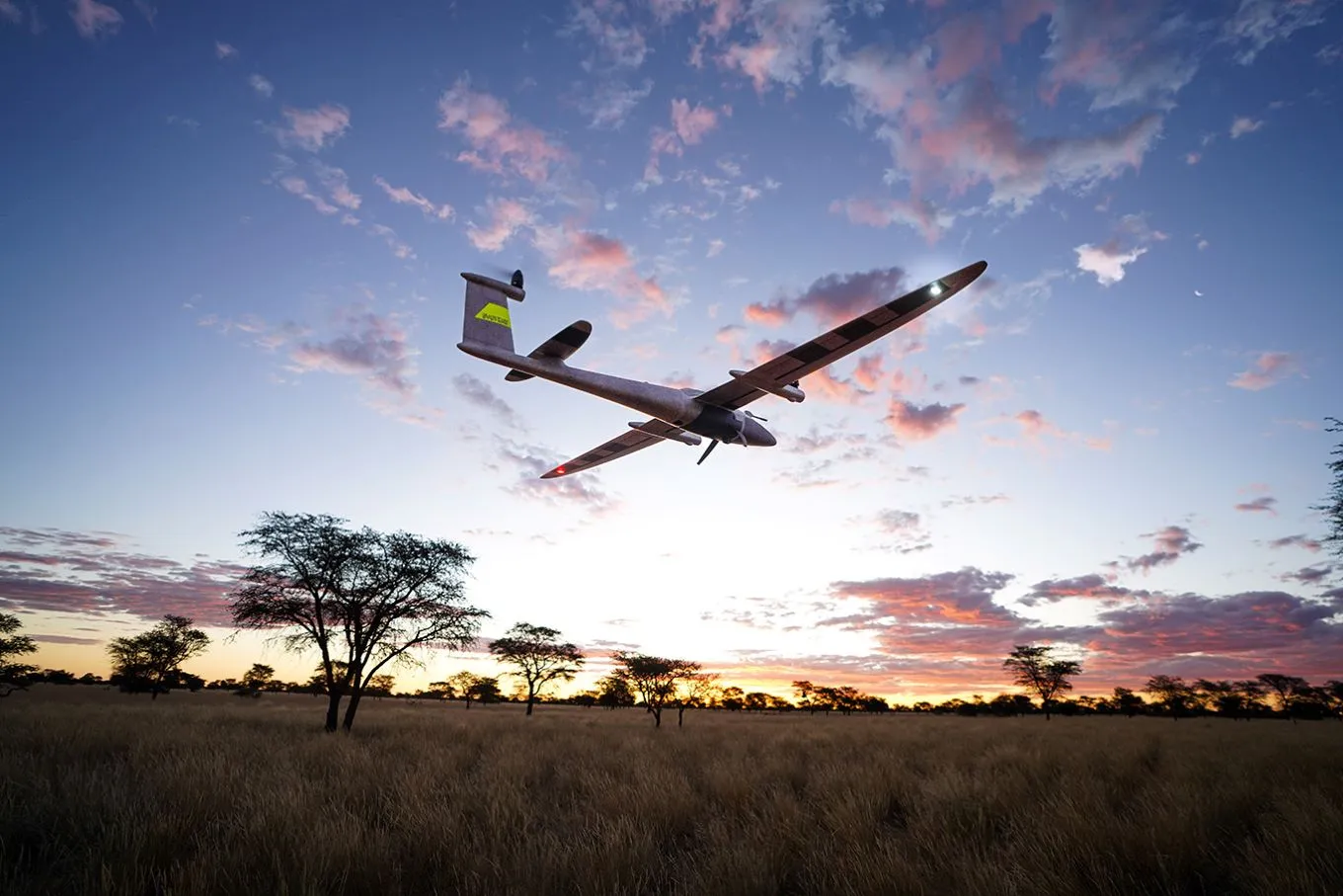
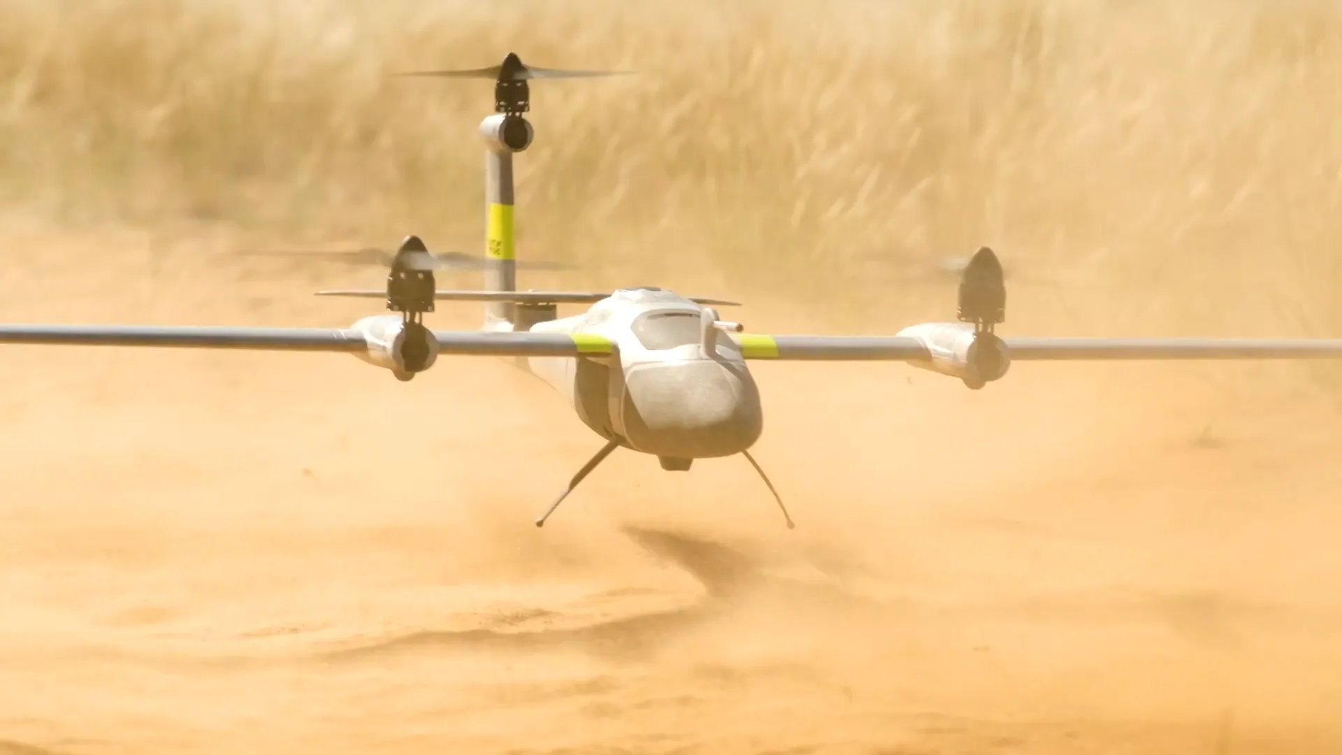
The Trinity Platform is a long-endurance eVTOL fixed-wing unmanned aerial system engineered to deliver efficient aerial data acquisition while maintaining flexible deployment capabilities in challenging environments. Developed by Quantum-Systems, the platform combines vertical take-off and landing capability with the aerodynamic efficiency of fixed-wing flight. During take-off and landing, dedicated lift motors allow the aircraft to operate without runways or catapults, enabling deployment in confined or remote environments. Once airborne, the aircraft transitions into forward fixed-wing flight powered by a rear propulsion motor, allowing significantly longer flight endurance and wider area coverage compared to conventional multirotor drones.

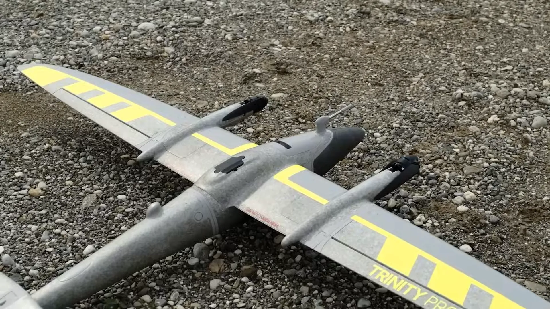
The platform’s modular design supports multiple mission configurations through interchangeable sensor payloads and onboard computing systems. The Trinity Pro configuration is primarily designed for commercial geospatial mapping and surveying applications, supporting high-resolution RGB cameras, multispectral sensors, and LiDAR payloads for photogrammetry and terrain modeling. This variant integrates tightly with Quantum-Systems’ QBase 3D mission planning software, enabling automated flight planning, terrain following, and efficient mapping workflows for industries such as agriculture, construction, and environmental monitoring.

Trinity Tactical

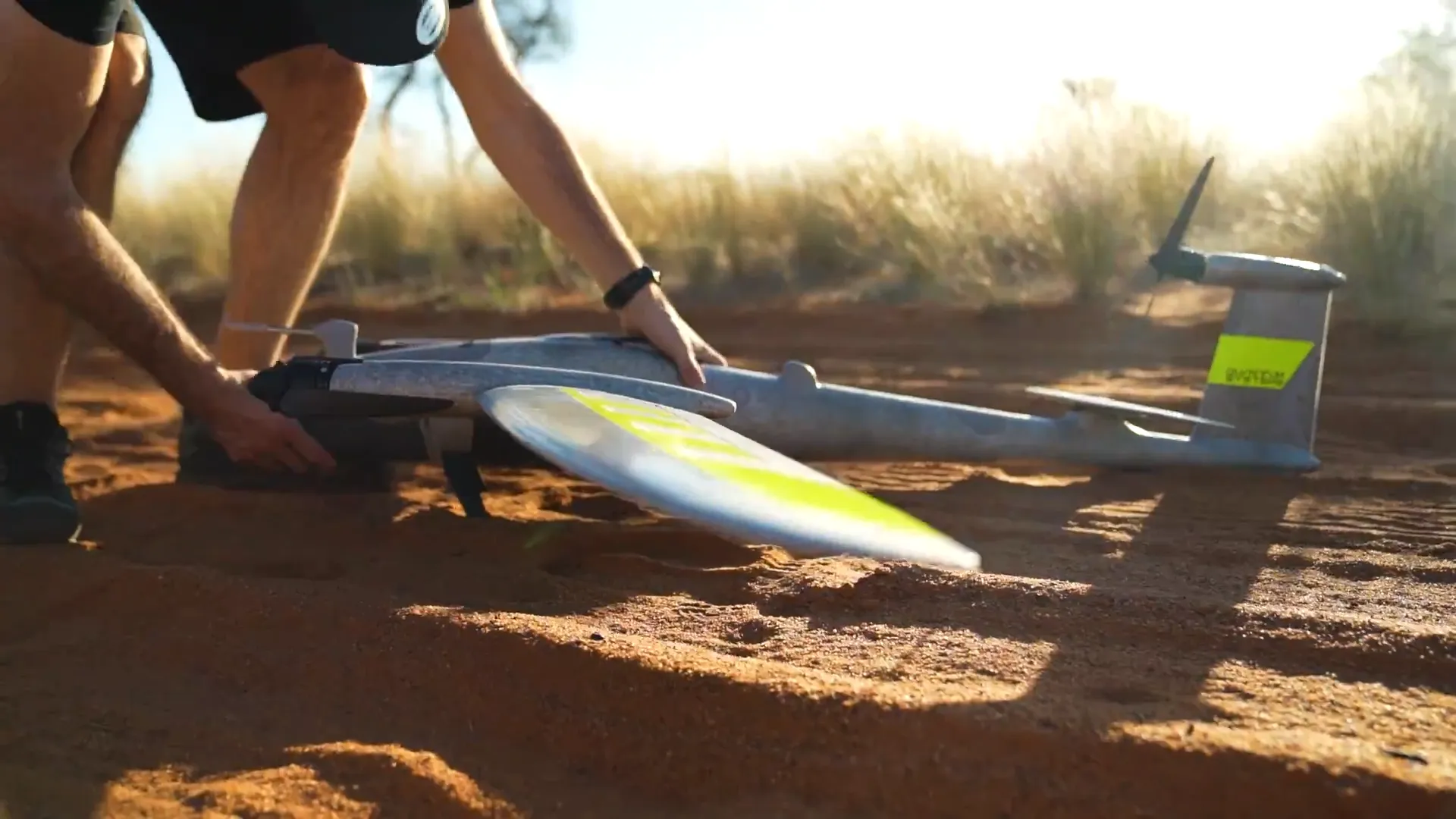
In contrast, the Trinity Tactical variant is optimized for defense and government operations where rapid deployment and situational awareness are critical. While retaining the same core airframe and flight performance, this variant supports ISR payloads, secure communication links, and tactical sensor systems for reconnaissance missions. Trinity Tactical is designed to be rucksack-portable, allowing operators to transport and deploy the drone quickly in forward operational environments without specialized equipment.

Both variants share the same aerodynamic architecture and endurance characteristics, enabling flight durations of approximately 90 minutes and coverage of hundreds of hectares in a single mission. The platform’s efficient wing design, autonomous navigation systems, and modular payload ecosystem allow the Trinity platform to serve a wide range of industries and operational environments, from commercial mapping and environmental monitoring to tactical reconnaissance and intelligence gathering.

Connectivity

  • 2.4 GHz radio link, ~5–7.5 km range

Capabilities

  • TOL Launch & Recovery:
    Vertical take-off/landing without infrastructure.
  • Fixed-Wing Endurance:
    Efficient flight for long mission durations.
  • Automated Flight:
    Advanced autopilot with terrain awareness.
  • Modular Payloads:
    Quick-swap sensors including RGB, oblique, multispectral, and LiDAR.
  • High-Precision Georeferencing:Supports PPK/RTK GNSS positioning for centimeter-level mapping accuracy without requiring large numbers of ground control points.
  • High Wind Resistance:
    The platform is designed to operate reliably in challenging weather conditions:
    • 11 m/s wind tolerance during VTOL hover
    • 14 m/s wind tolerance during cruise flight
    • 18 m/s gust tolerance