Enquire about Robot

Simply fill up the form, our team will then reach out to you to connect to the relevant parties who can help facilitate your request.

Brand & Model
All fields required. Refer to our privacy policy for questions.
Thank you! Your submission has been received!
Oops! Something went wrong while submitting the form.
HomeRobots

Bluefin-21

Bluefin-21 is a deep-rated modular autonomous UUV with long endurance, advanced navigation, and multi-sensor payloads for defense, oceanography & subsea survey.
Software Type
Closed Source
Software Package
Uses proprietary software, the Operator Tool Suite, include Bluefin Dashboard and Bluefin Planner, a complete UUV that provides interface between UUVs and operator for all mission. Bluefin-9 supports SeeByte’s SeeTrack 4, which allow operator to graphically plan missions on nautical charts and specify operational and safety limits, recovery points and return plans.
Aparobot Readiness Score
ARS?
0
...
Actuators
Gimbaled, ducted thruster for propulsion and control.
Compiute
Sensors
Equipped with Sonardyne Solstice 3000 Multi-Aperture Sonar (MAS), Nortek Doppler Velocity Log (DVL). Standard modular payloads include EdgeTech 2200-M 120/410 kHz side scan sonar, EdgeTech DW-216 sub-bottom profiler, Reson 7125 400 kHz multibeam echosounder.
Max Op. time
1500
mins

Recent Robot Videos

*Aparobot claims no ownership of videos posted unless otherwise stated.
Description text
Date

Robot Brief

The Bluefin-21 is a deep-rated, modular autonomous UUV engineered for sustained, high-resolution underwater data collection across defense, scientific, and industrial missions. Designed with reusable payload sections and swappable battery modules, it combines long endurance, extremely deep dive capability, accurate navigation, and flexible payload integration, enabling tasks from seabed mapping and archaeology to mine countermeasures and oceanographic research. Its robust design and modularity make it deployable from a variety of surface vessels and support rapid turnaround between missions.

Use Cases

  • Underwater survey & mapping:
    Produces detailed subsea topography and seabed imagery.
  • Oceanographic & environmental sensing:
    Collects temperature, pressure, sound velocity, and related data.
  • Search & salvage operations:
    Detects submerged objects, hazards, or wreckage.
  • Mine countermeasures (MCM) & unexploded ordnance (UXO):
    Supports detection of underwater hazards.
  • Remote ISR & reconnaissance:
    Integrated sensors support defense and maritime security missions.

Industries

  • Defense & Military:
    ISR, MCM, port/harbor security, and seabed reconnaissance.
  • Maritime & Oceanography:
    Environmental and bathymetric surveying.
  • Search & Recovery:
    Post-incident underwater search missions.
  • Industrial R&D:
    Subsea infrastructure inspection and research applications.

Specifications

Length
-
4630
mm
Width
-
530
mm
Height (ResT)
-
mm
Height (Stand)
-
mm
Height (Min)
-
mm
Height (Max)
-
mm
Weight (With Batt.)
-
750
kg
Weight (NO Batt.)
-
kg
Max Step Height
-
mm
Max Slope
+/-
-
°
Op. Temp (min)
-
°C
Op. Temp (Max)
-
°C
Ingress Rating
-
No items found.

Intro

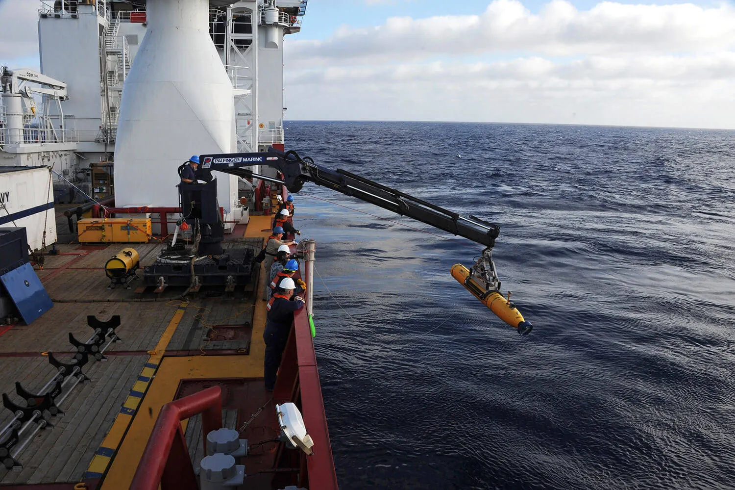
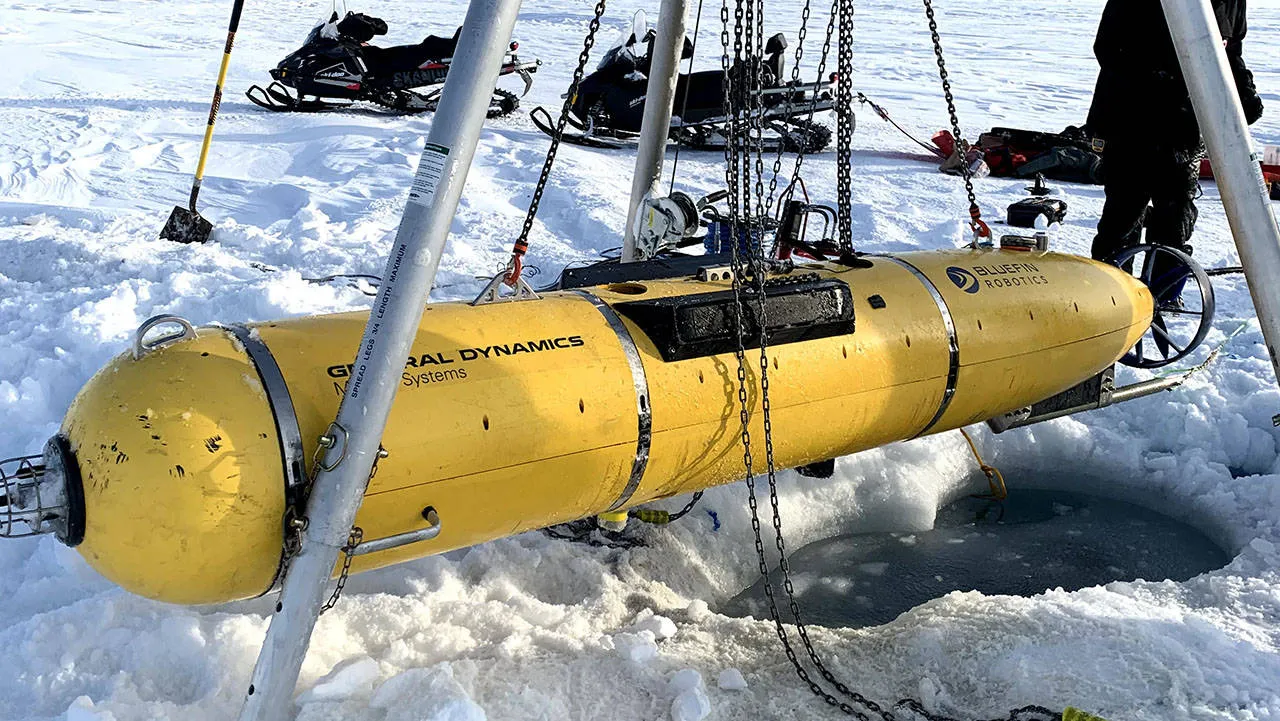
The Bluefin-21 is a large, deep-rated autonomous undersea vehicle developed for demanding subsea missions where deep penetration, long duration, and high-resolution data collection are crucial. With a 53 cm diameter, 4.93 m length, and dry weight of 750 kg, it is built with a free-flooded modular architecture that supports rapid payload and battery reconfiguration in the field.

Its modular design enables integration of multiple advanced sensors simultaneously — such as side-scan sonar, sub-bottom profilers, and multibeam echosounders, giving Bluefin-21 the flexibility to be tailored for oceanographic research, hydrographic mapping, mine countermeasure support, or unexploded ordnance exploration.

Powered by nine 1.5 kWh lithium-polymer pressure-tolerant batteries (13.5 kWh total), the UUV can operate for up to 25 hours at 3 knots with a standard payload, while its gimbaled ducted propulsion offers stable, efficient motion through varied water conditions. Navigation employs a fusion of INS, DVL, SVS, GPS when surfaced, and USBL tracking to achieve real-time positioning with ≤0.1 % dead-reckoning drift accuracy (CEP 50).

Communications are supported via RF, Iridium satellite, and acoustic links, with additional Ethernet connectivity when interfaced through shore power cables. Safety features include fault and leak detection, dropweights, acoustic transponders, strobe lights, and radio direction finders — all independently powered for mission resilience.

Connectivity

  • Ethernet, Wi-Fi supported.
  • Bluefin TOPICS: A High-latency and low-bandwidth communications infrastructure. Enabling remote monitoring and command of the vehicle during missions.
  • Iridium satellite (Over-the-Horizon) communications: Provides global, beyond-line-of-sight connectivity when the vehicle is surfaced, enabling mission status reporting and command updates from remote locations.
  • Acoustic communications (surface-enabled): Supports acoustic data exchange while the vehicle is on or near the surface, allowing limited command and status updates without physical recovery.

Capabilities

  • Deep-water modular survey:
    Swappable payload sections for multi-sensor missions.
  • Long endurance operation:
    ~25 hours mission duration at 3 knots.
  • High-precision navigation:
    INS + DVL + USBL for minimal drift.
  • Flexible communication suite:
    RF, Iridium, and acoustic comms.
  • Robust safety systems:
    Leak detection, dropweights, RDF/transponder, and strobes.
  • Multi-terrain imaging support:
    Side-scan sonar, sub-bottom profiler, and echosounder payloads available.