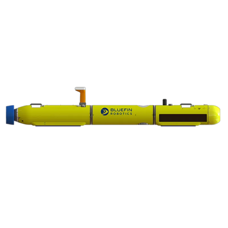
Enquire about Robot

Simply fill up the form, our team will then reach out to you to connect to the relevant parties who can help facilitate your request.

Brand & Model
All fields required. Refer to our privacy policy for questions.
Thank you! Your submission has been received!
Oops! Something went wrong while submitting the form.
HomeRobots

Bluefin-9

Bluefin-9 UUV is a portable autonomous underwater vehicle with advanced sonar, navigation, and environmental sensing for defense, survey, and ISR.
Software Type
Software Package
Uses proprietary software, the Operator Tool Suite, include Bluefin Dashboard and Bluefin Planner, a complete UUV that provides interface between UUVs and operator for all mission. Bluefin-9 supports SeeByte’s SeeTrack 4, which allow operator to graphically plan missions on nautical charts and specify operational and safety limits, recovery points and return plans.
Aparobot Readiness Score
ARS?
0
...
Actuators
Gimbaled, ducted thruster for propulsion and control.
Compiute
Sensors
Equipped with Sonardyne Solstice 3000 Multi-Aperture Sonar (MAS), Nortek Doppler Velocity Log (DVL). Standard modular payloads include Side Scan Sonar With Full Swath Bathymetry, HD Machine Vision Camera, Sound Velocity Sensor + Temperature + Pressure, Turbidity and Fluorometry.
Max Op. time
480
mins

Recent Robot Videos

*Aparobot claims no ownership of videos posted unless otherwise stated.
Description text
Date

Robot Brief

The Bluefin-9 is a two-man-portable autonomous Unmanned Underwater Vehicle (UUV) designed to deliver high-resolution subsurface data with precision navigation, a modular architecture, and rapid mission turnaround time. Built around a carbon fiber hull with integrated sensors, advanced sonar, camera systems, and removable data/battery modules, the Bluefin-9 enables detailed hydrographic mapping, environmental assessment, search & recovery, security, and intelligence, surveillance and reconnaissance (ISR) missions in littoral and open-water environments,

Use Cases

  • Hydrographic & Bathymetric Survey:
    Generates high-resolution seabed maps.
  • Environmental Sensing:
    Measures water temperature, sound velocity, turbidity, fluorometry, and currents.
  • Search & Recovery:
    Detects and visually records submerged objects or areas.
  • Security & Force Protection:
    Underwater ISR for port/harbor defense and route survey.
  • Autonomous Data Collection & Actionable Output:
    Processes sonar and camera data onboard for rapid analysis.

Industries

  • Defense & Military:
    ISR, port security, mine countermeasure support.
  • Maritime Security:
    Underwater surveillance of critical infrastructure.
  • Environmental & Industrial:
    Hydrographic surveys, environmental assessment.
  • Academic & Research:
    Oceanography and environmental data collection.

Specifications

Length
-
2418
mm
Width
-
238
mm
Height (ResT)
-
264
mm
Height (Stand)
-
264
mm
Height (Min)
-
264
mm
Height (Max)
-
264
mm
Weight (With Batt.)
-
70
kg
Weight (NO Batt.)
-
kg
Max Step Height
-
mm
Max Slope
+/-
-
°
Op. Temp (min)
-
°C
Op. Temp (Max)
-
°C
Ingress Rating
-
No items found.

Intro

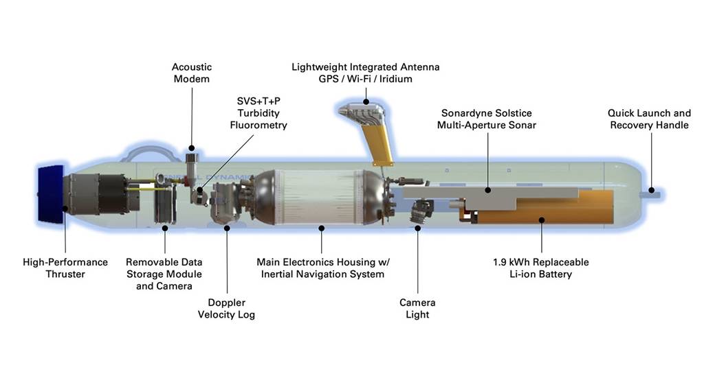
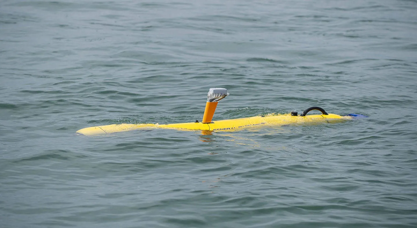
The Bluefin-9 is an autonomous unmanned underwater vehicle engineered for portable, high-fidelity subsea missions. Its carbon fiber body houses an integrated suite of advanced sensors—most notably the Sonardyne Solstice Multi-Aperture Sonar (MAS), which delivers high-contrast, undistorted side-scan imagery across a ~200 m swath with ultra-high resolution comparable to larger synthetic aperture systems.

Navigation is achieved through a combination of Nortek Doppler Velocity Log (DVL), Inertial Navigation System (INS), and other onboard sensors to provide precise, geo-referenced data with approximately 0.3% dead-reckoning error. This enables the vehicle to autonomously follow missions and return high-accuracy bathymetric and environmental information.

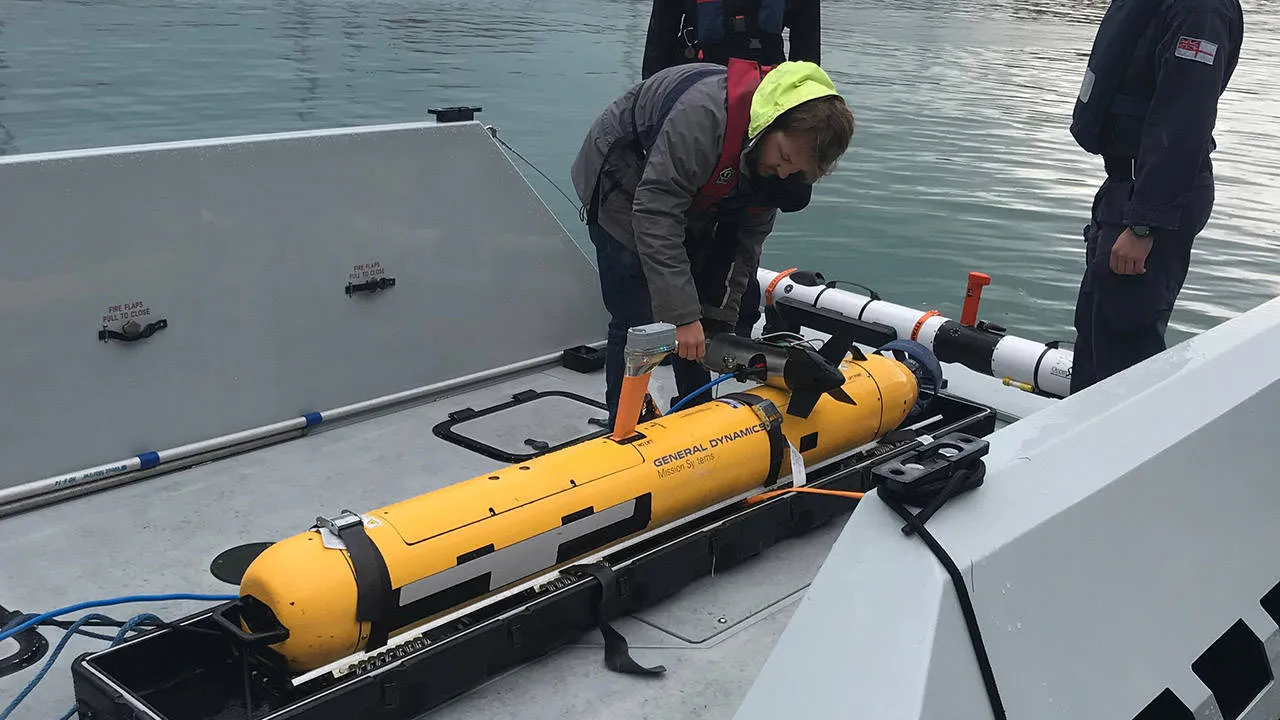
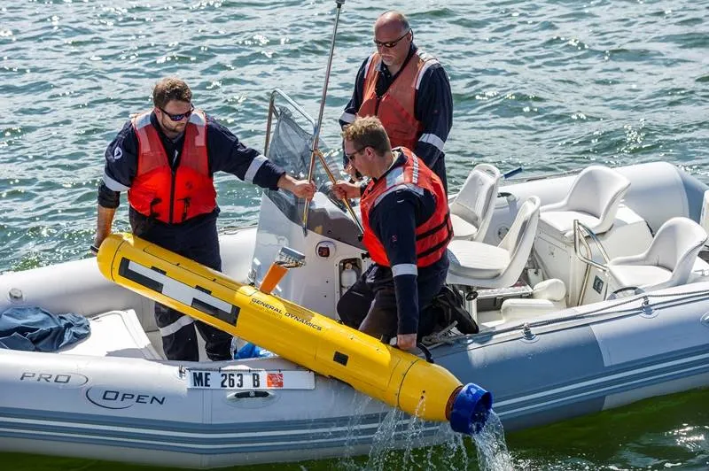
The vehicle features modular design elements, including a removable 1.9 kWh lithium-ion battery and a 1 TB Removable Data Storage Module (RDSM), which can be swapped and accessed in the field in under ~30 minutes, dramatically reducing turnaround time between missions. Onboard processing allows operators to retrieve mission-ready data—sonar, camera imagery, and environmental measurements immediately post-mission.

Standard sensor payloads include side-scan sonar, machine vision camera (including LED-illuminated seafloor optics), sound velocity, temperature, pressure sensors, turbidity and fluorometry instruments, and current profiling. The Bluefin-9 also integrates surface aids such as LED strobes and a radio direction-finding beacon for recovery.

Connectivity

  • Ethernet, Wi-Fi supported.
  • Bluefin TOPICS: A High-latency and low-bandwidth communications infrastructure. Enabling remote monitoring and command of the vehicle during missions.
  • Iridium satellite (Over-the-Horizon) communications: Provides global, beyond-line-of-sight connectivity when the vehicle is surfaced, enabling mission status reporting and command updates from remote locations.
  • Acoustic communications (surface-enabled): Supports acoustic data exchange while the vehicle is on or near the surface, allowing limited command and status updates without physical recovery.

Capabilities

  • High-Resolution Side-Scan Sonar:
    Sonardyne Solstice MAS with ~200 m swath and ultra-high resolution 0.15° along-track.
  • Precise Navigation:
    DVL + INS with 0.3% dead-reckoning CEP accuracy, collecting information on water currents up to 30 meters.
  • Environmental Sensing:
    Measures water temperature, sound velocity, turbidity, chlorophyll-a, and current profiles.
  • Visual Imaging:
    HD machine vision camera and low-light seafloor optical imaging with LED floodlight.
  • Modular Field Maintenance:
    Hot-swap battery & 1TB RDSM in 30 minutes for rapid redeployment.
  • Real-Time Status & Monitoring:
    Internal environment and systems sensors for performance & leak detection.
  • Surface Recovery Aids:
    Visible LED strobes & RDF beacon.